The wind was so powerful that the map was torn in two in my hands. I realised that my planned hike would have to be drastically shortened. The incident also served as a potent reminder that, whatever the season, a mountain can always have the last word. Pen Y Fan Walk report by wildlife and travel writer Neil Harwood …
[mc4wp_form]
Pen Y Fan Walk in Bad Weather
It was a classic case of ‘you should have been here yesterday’. Annoyingly, I had actually been here yesterday! I had spent the day planning potential hikes and getting my bearings in Wales’ Brecon Beacons National Park, and had called in at the visitor centre for information. I was planning a 10+ mile walk for which I had already downloaded directions. It would include an ascent of Pen Y Fan.
Even then the skies had been overcast, but at least some of the mountain had been visible. There were even fleeting patches of sunlight on the mountainside. As the song goes: what a difference a day makes!
Now, being pelted by rain and buffeted by strong winds, I was regretting not being a little more spontaneous and making the climb there and then. Instead, after picking up a free paper map from the visitor centre, I continued on my drive to Brecon. I figured it would be prudent to do the Pen Y Fan walk equipped with a proper map rather than a free handout.
The Brecon Beacons and Pen Y Fan
Pen Y Fan is the highest mountain in south Wales, and one of the 6 main peaks of the Brecon Beacons range. Pen Y Fan, at 886 metres, is not a record-breaker, but the straight up and down walk is nevertheless strenuous, and serves as a good introduction to hill walking.
In fact, the 2 mile path up to Pen Y Fan’s peak is so heavily used that it has become known as ‘The Motorway’.
However, there is more than one way to climb a mountain. Away from the main path, Pen Y Fan’s slopes can be just as challenging as those of any other mountain. It is for good reason that Pen Y Fan and its neighbouring peaks are used by the British army for training exercises.
A Mountain’s Moods

Like any mountains, the Brecon Beacons have distinctive moods. Find them in a good mood, and you’ll be rewarded with green valleys, crystal clear rivers and streams, and views across to neighbouring peaks and ridges. If, however, you find them in a bad mood, then you’ll realise why the trees are stunted and the only animals found on the slopes are hardy mountain sheep.
On the day of my climb, the mountain was very definitely in a bad mood. The clouds had descended, and rain lashed across its exposed faces.
At the car I fretted about what to pack. Of course, the essentials went in first: food, water, map, but should I take my camera? I’d regret not having my binoculars with me if the weather cleared, but how likely was that?
In the end I managed to leave the kitchen sink. Everything else I took. I still planned to do the 10+ mile hike, and was now suitably equipped with the relevant OS map.
With hindsight, I was way too optimistic. The weather was only ever going to get worse. The expensive DSLR should never have gone: my camera phone would have been adequate. The binoculars? What had I been thinking? An extra 1kg all the way up and down? In the driving rain and strong wind I didn’t have the luxury of looking at birds.
I left the car and made my way to the beginning of the trail. I noted that there were fewer people venturing up than yesterday. Also, the visitor centre was closed. Not good signs.
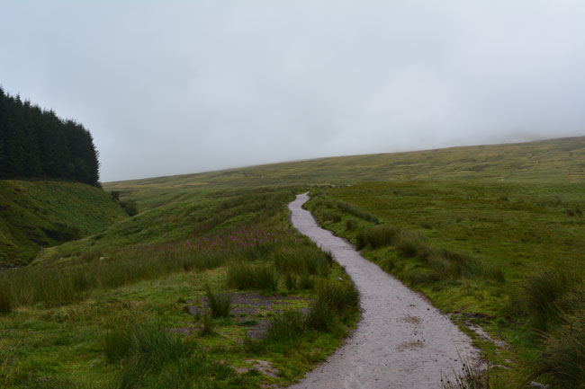
Still, nothing ventured, nothing gained. I started walking up the trail. The ascent started as soon as I left the car park. A mountain stream burbled away to my left. Further over was a small forested area. Sheep were grazing on the hillside to my right. Visibility wasn’t great, but it could have been worse. The rain was steady, but light. I was confident that my waterproof trousers and Gore-Tex jacket would keep me dry.
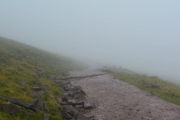
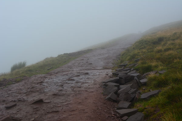
I gradually made my way above the treeline. The wind started picking up, as did the rain. Visibility went from ‘poor’ to ‘poorer’. I quickly realised that there weren’t going to be any valley views. I could see around 20 metres max. Then it got worse.
Is it braver to continue a hike in bad conditions or to turn back and admit defeat? Undoubtedly the latter; which is why I’ve never been able to do it.
The greenery disappeared into the mist. All I could see was damp and grey. I felt cocooned. The blobs of white on either side of the path were probably sheep. People coming the other way quickly faded in and out of my world. A brief ‘hello’ and an ironic smile communicated the ridiculousness of our shared situation. Then they would once again disappear into the cloud.

Finally I reached a peak. By this time the wind had picked up even more, and on this exposed, rocky incline I was in real danger of being knocked over.
The Wrong Mountain
As I climbed up to the top I was suddenly struck by an awful realisation: it wasn’t Pen Y Fan! I had climbed the wrong mountain! I had been following the path rather than the map. This was in fact Corn Du, a neighbouring mountain.
At least I wasn’t alone in making this schoolboy error. The other two people scrambling down from the peak had climbed it believing it to be the bigger mountain.
I realised where I had left the path to Pen Y Fan, and made my way back down to where the path had split. I had given up any thoughts of a longer hike. My mission now was simple: get to the top of Pen Y Fan and back down in one piece.
Once again I became surrounded by cloud and my world shrank to a 10 metre bubble. I passed a group of squaddies. I imagine that whatever they were doing on the mountain was infinitely tougher than a simple climb up and down. I stood up straight and walked manfully past them. Once they were safely out of sight, I resumed my normal gait.
Pen Y Fan Peak
Finally the terrain became rockier and the remaining vegetation vanished. The wind swept across the exposed ridge from behind me, pushing me ever forwards. Rain hammered into my back and my waterproofs gave up any pretence of being adequate for the downpour. I scrambled across the rocks, feeling that I was approaching the peak.
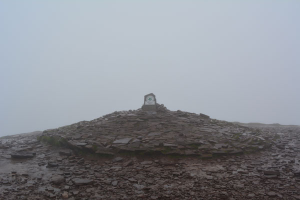
Sure enough, from out of the mist appeared the stone marking the top of Pen Y Fan. The wind and rain were at their strongest here, and I struggled to retain my balance as I photographed the summit.

Once the camera was safely back in the relative dryness of my backpack, I turned and began the descent.
And then the combined strength of the wind and rain really hit me. While walking in the same direction as the wind, I had failed to properly appreciate just how strong it was. Now, facing the onslaught head on, I found I couldn’t even look into the driving rain.
Shielding my eyes, I again reached the split in the path. Wanting to be sure that I was taking the correct route, I produced the paper map from my backpack. As I held it out, it was ripped in two by the wind. After a quick, but far more careful perusal of the OS map, I resumed my descent.
As I got lower down the mountain conditions improved marginally, but it was still a case of ‘head down, get back to the car asap’, rather than taking in the views. Not that there were any: the cloud hadn’t lifted.
The car park quickly came into view. As ever, the return journey seemed shorter than the way out. Soon I was making my way across the concrete towards my car. Sheltering under the raised boot door, I realised that there wasn’t an inch of my body that wasn’t sodden.
The Next Time
I wasn’t quite guilty of disrespecting the mountain: I had made the decision not to do the full hike as soon as I realised that the conditions weren’t suitable. However, I had misjudged the conditions at the start, and had taken too much unnecessary gear.
Next time I climb Pen Y Fan, I’ll make sure that the weather forecast is good. Hopefully I’ll catch the mountain in a better mood, and be rewarded with the views I missed out on this time. That said, I’m glad I went up. Exposing oneself to a little risk is not always a bad thing in our over-safe modern world. I’ll put the Pen Y Fan walk down not just as a lesson learnt, but also as a memorable experience in its own right.

